mysite
1950 Cotes du Rhone
1950 Cotes du Rhone
Couldn't load pickup availability
By: Remy Hetreau
Date of Original: 1950 (published) France
Original Size: 23.5 x 31 inches (59.7 x 78.75 cm)
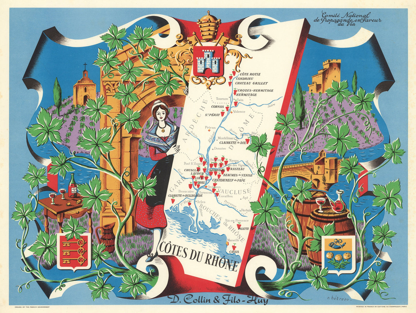
This is a?fine print reproduction of a marvelous promotional travel poster from 1954. It was part of a series of maps commissioned by the?Comite National de Propagande en Faveur du Vin?to celebrate and promote the legendary wine regions of France. Remy Hetreau, French?illustrator and print maker took on this task, creating?a set of magnificent posters highlighting local wineries of eight different regions.
The Map is dramatically embellished with crests and vines in the foreground and background of vineyards with a historical church, and castle set on hilltops. Architectural elements of bridges and a large archway further decorate the image while barrels and filled wine glasses, a decanter, and open bottle entice the viewer for a drink. A maiden in traditional garb supports the rectangular map of the Rhone Region in France that starts just south of Lyon and follows the river valley to its terminus in the Mediterranean just west of Marseille.
The Rhone River Valley is divided into two sub-regions that produce red wines. The Northern Rhone is known for?red wines from the Syrah grape, sometimes blended with up to 20% of white wine grapes. The Southern Rhone?produces an array of red, white and ros¨¦ wines, often blends of several grapes. It is believed that the earliest cultivated vines in this region may have been planted sometime around 600 BC?when the Greeks brought the?Syrah grape to the region. Today?over 6,000 wine growing properties including 1,837 private wineries and 103 cooperatives operate in the Rhone Valley.
Inventory #10776