mysite
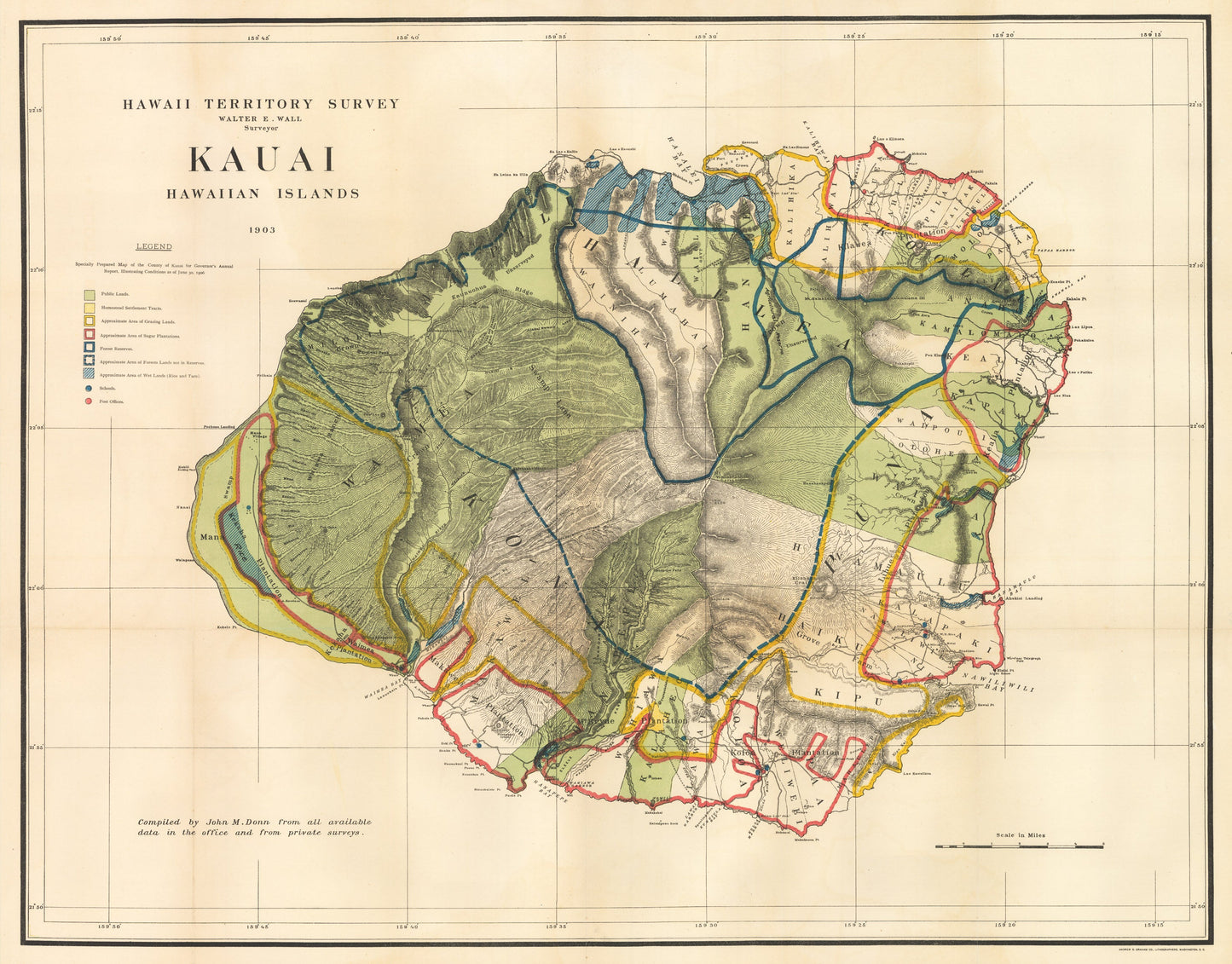
1903 Hawaii Territory Survey | Kauai Hawaiian Island
1903 Hawaii Territory Survey | Kauai Hawaiian Island
Nie można załadować gotowości do odbioru
Hawaii Territory Survey | Kauai Hawaiian Island
By:?Walter E. Wall
Date of Original:?1903 (dated) Washington, D.C.
Original Size:?23.5 x 30.25 inches (59.7 x 76.84 cm)
This is a fine print reproduction of an attractive and colorful large map?of the island of Kauai, Hawaii. Originally published in 1903,?the map represents the culmination and results of the first systematic and scientific survey of the island, which took place in the 1870s under the Hawaiian Monarchy. It focuses on Kauai¡¯s potential for development of its natural resources.
The map is highly detailed topographically, conveying a wealth of information concerning pineapple and sugar plantations, forest lands and reserves, grazing lands and wetlands, public lands and homestead settlement plots. Topographic details which would enhance administration of these lands are also well defined.
A color coded legend enables identification of public lands, homestead settlement tracts, approximate area of grazing lands, approximate area of sugar plantations, forest reserves, approximate area of forest lands not in reserves, approximate area of wet lands, along with schools and post offices.
Inventory #11695